
What happens when park rangers monitor land cover via Terra-i’s eyes? Training experience in Oxampampa, Peru


During the week of September 29 to October 3, the "Training Course in Geographical Information Management Module 2", was held at the province of Oxapampa – Peru. This course, which included training on the use of the Terra-i PERU web tool, is part of several training workshops conducted by the National Service of protected Areas (SERNANP) and supported by the General Directorate of Land Management (DGOT). Both these institutions are part of the Peruvian Ministry of Environment (MINAM). In particular, most of the trainees were specialists on protected areas from the Central region of the Peruvian Rainforest.
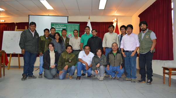
Figure 1. Group photo with the national protected area specialists who participated in the training accompanied by Ovidio Monzón (SERNANP) and Jhon Tello (Terra-i team). Pic by: Jaime Valenzuela.
The following main areas were reviewed as part of the training: monitoring systems and early warning tools for land cover and land-use change detection (including Peru’s own Terra-i web tool); methods and techniques for data collection using GPS equipment; high resolution satellite imagery processing and analysis; verification and validation protocols for land-use information; and management and use of GIS software such as Quantum GIS and ArcMap.
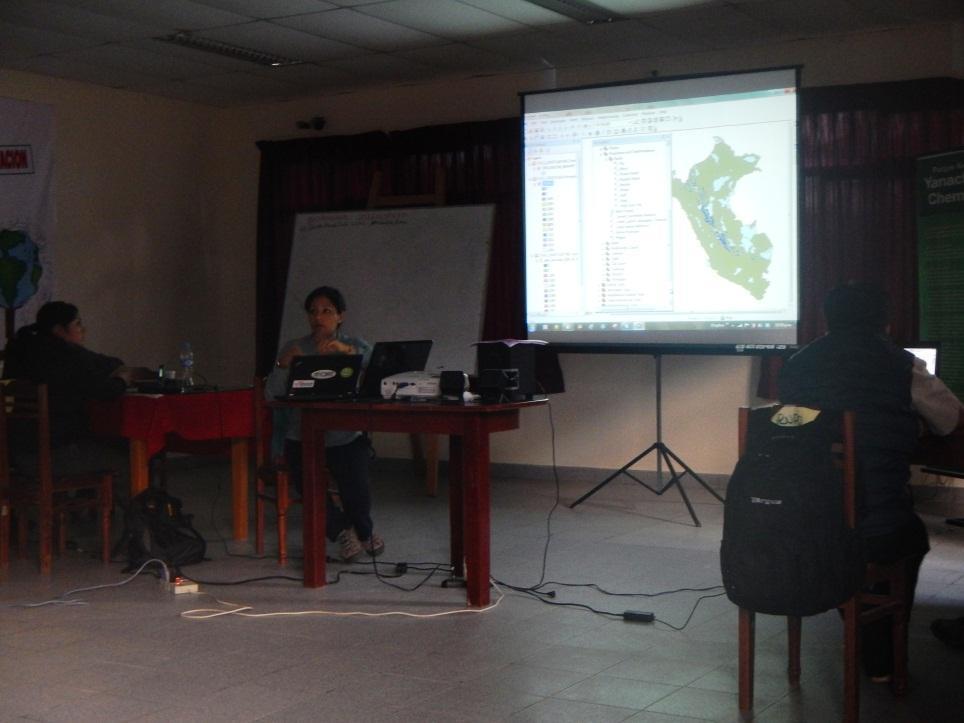
Figure 2. Kelly Salcedo, GIS specialist from DGOT-MINAM, demonstrating how to estimate areas using geospatial data from the Terra-i Peru web tool.
The training event began with an "Open meeting for agencies and local actors", which besides the DGOT, SERNANP and Terra-i specialists, also included local representatives from Universidad Nacional Daniel Alcides Carrión Oxapampa (UNDAC in Spanish), Centro de Estudios y Promoción del Desarrollo DESCO, Municipality of Huancabamba, Municipality of Chontabamba, Regional Program of Environmental Education (PREA in Spanish) based in Pasco, Regional Government of Pasco, and Unidad ejecutora Pasco Selva Central (GRP UEPSC in Spanish).
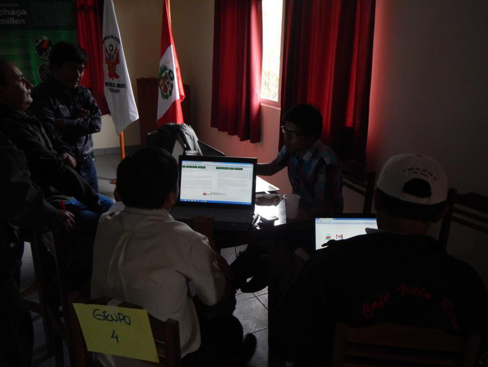
Figure 3. Protected natural areas specialists from SERNANP, working on a practical exercise about vegetation changes reporting in a protected area using the information available in the Terra-i Perú website.
During the open meeting, Jhon Tello from CIAT’s Terra-i team gave an introductory talk covering (1) Terra-i as an early warning and land cover monitoring system, and (2) field validation protocols of land use change information. To this aim, Jhon first gave a general overview of Terra-i, and then presented various applications, impacts and achievements of the Terra-i tool at the regional level. Then, an introduction to the Terra-i PERU web tool was given by the Terra-i trainer. This included an overview of the main functionalities of the tool, launched in collaboration between the DGOT and the Terra-i team. Finally, an overview of the first field validation of the Terra-i system in the Ucayali region (Peru) was presented.
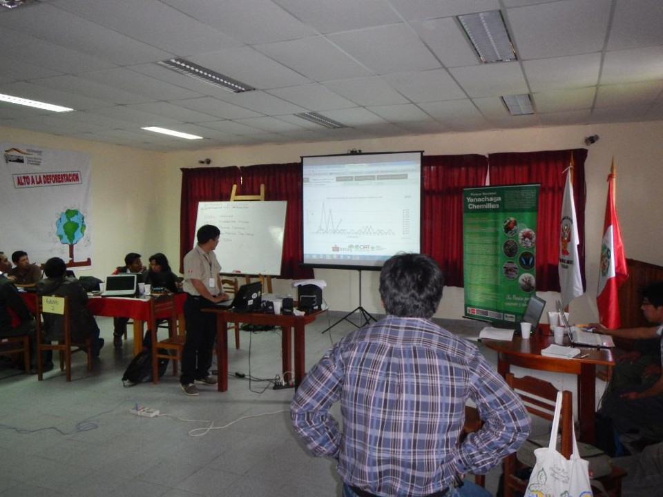
Figure 4. Natural protected areas specialists from SERNANP socializing the results after performing some queries through the Terra-i Peru online tool.
Aided by DGOT staff, the Terra-i trainer explained how to query and download information for a specific area through the web tool. In addition, through a set of practical exercises the trainers showed and iterated with the participants how to use and interpret Terra-i’s geospatial data using GIS software such as QGIS (open source) and ArcGIS (ESRI licensed). As a result, the trainees shared their main findings, highlighting the importance of the tool and its versatility to make coherent reports with the data available. Importantly, trainees were also able to associate observed changes with their own anecdotal information and in cases were able to trace back causes of the changes found through Terra-i’s eyes. Further feedback was gathered at the end of the event as the SERNARP staff expressed their interest in displaying some spatial layers of their own on the Terra-i Peru website. Empirical validation as well as further display of information will likely improve Terra-i’s capabilities and hence enhance its usability amongst relevant actors.
The Terra-i team thanks the Dirección General de Ordenamiento Territorial del Ministerio del Ambiente - DGOT and the Servicio Nacional de Áreas Naturales Protegidas - SERNANP for the support provided during the development of this training.
Blog post by Jhon Tello. Revision of English-language version by Julian Ramirez (CIAT / CCAFS Postdoctoral researcher) and Alejandro Coca ( Terra-i member).


The Terra-i team together with CRS El Salvador under the Raices project carried out a virtual workshop through the teams platform to technicians from the Ministry of Environment and Natural Resources, CARITAS, Universidad El Salvador, CENTA, about the Mapping of land cover using remote sensors and open source tools such as GEE, SEPAL and QGIS- Plugin Semi Automatic Classification.


Near real-time vegetation loss detection in Southwestern Ethiopia: calibration, validation, and implementation of the Terra-i system


The Alliance of Bioversity International and the International Center for Tropical Agriculture (CIAT) (the Alliance) conducted a training for local stakeholders on the use of Terra-i as part of the collaboration with the Netherlands Development Organisation – SNV in the Coffee Agroforestry and Forest Enhancement for REDD+ (CAFÉ-REDD) Project.


From May 8-12, 2017, the Terra-i team, together with staff from the DGOTA of Peru's Ministry of Environment, carried out the first field validation of vegetative land cover changes detected during Terra-i monitoring for 2016 and 2017, using the technology UAV. This work was carried out under the framework of the project “Sustainable Amazonian Landscapes”. The team carried out over-flights with a Phantom 3 advanced rotor drone and a fixed-wing Ebee drone in seven townships of Yurimaguas. The objective of this work was to recognize the dynamics of land cover and land use changes in the region while at the same time to validate the accuracy of the detections of forest loss being monitored by Terra-i in Yurimaguas.


The Terra-i team has worked hard on renovating Terra-i’s website since early this year. A set of new features on the website provides interactive contents and facilitates adaptation to the mobile devices of our users. The fresh website was developed using the latest update of an open-source, Java-based web system, Magnolia CMS 5.4.4. This update was customized to add different categories of interaction such as news, vegetation cover changes, and information, among others.


Globally more than 1 billion people depend on forests for their livelihoods. Forests play a crucial role in climate regulation, ecosystem services provision and regulation, water supply, carbon storage and many other functions that support biodiversity. Currently the global rate of deforestation is substantial, and there is a growing need for timely, spatially explicit data that flag natural vegetation changes due to human activities.


The latest update of Terra-i has been used with the Co$ting Nature ecosystem services assessment tool to understand the impacts of recent forest loss in Colombia on biodiversity and ecosystem services.


During the 1st and 12th of June 2015, the Terra-i team, together with the Instituto de Investigaciones de la Amazonía Peruana (IIAP) and the Universidad Nacional Agraria La Molina (VLIR-UNALM), conducted the second field validation of the data produced by the Terra-I system. This time, the study area was the Yurimaguas district, Alto Amazonas province, Loreto region (Peru). We used information on populated places, main roads, rivers and information on land cover changes detected for 2013, 2014 and 2015 to define the 65 sampling points (or Terra-I pixels) for the validation process (Figure 1).